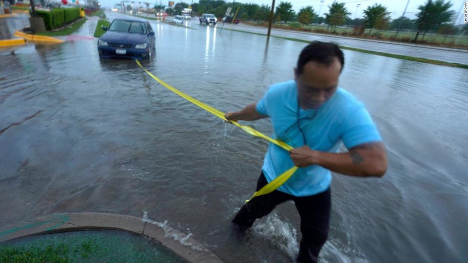
Hundreds of traffic accidents also have been reported, according to the Dallas Police Department.
“I’ve never experienced anything like this in my entire life,” said Brittany Taylor, who moved to her Dallas apartment just two days before Monday morning’s flooding left most of her belongings ruined by the flood.
Taylor woke up around 3 a.m. to the sound of the torrential rain and couldn’t fall back asleep owing to the sound of leaking, she told CNN.
“All the cardboard boxes started collapsing, so a lot of my belongings started crashing into the water. I lost a lot of my stuff,” she said, adding her renter’s insurance doesn’t cover flood losses.
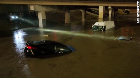
Fast-rising water trapped vehicles around 3 a.m. on Interstate 30 in Dallas, said Cassondra Anna Mae Stewart, who took video of the dark, watery scene.
“I was able to back up on a ramp to get off the highway,” she said. “I took an alternate route home … although most streets are flooded down there as well.”
Around that time, “trained weather spotters reported major flash flooding ongoing across Dallas with numerous roads and cars submerged, including Interstate 30 at Interstate 45 near downtown Dallas,” according to a flash flood warning statement issued at 3:21 a.m.

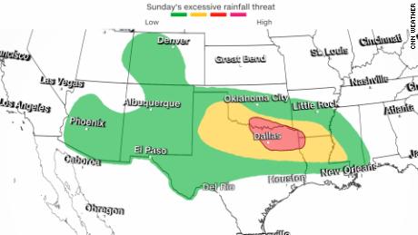
Other major cities in Monday’s flood watch zone include Austin, Texas, and Shreveport, Louisiana. The region is under a moderate — Level 3 of 4 — risk of excessive rainfall. Rainfall rates of 2 to 3 inches per hour have been observed as storms move slowly across the area, creating the potential for up to 3 to 5 inches of rainfall.
A sign of ‘climate whiplash’
The Dallas-area deluge comes in concert with a “flash drought” that has developed over this extremely dry year across Texas. Exceptional drought — the highest designation — is present over Dallas and Tarrant counties and blankets more than a quarter of the state.
“Over the last half-year, rainfall deficits of 8 inches to locally over a foot have affected areas of central Texas near and south of Dallas/Ft. Worth to the Gulf Coast,” the Drought Monitor summary said Thursday.
But those rainfall deficits will be essentially erased after Monday in Dallas, though large deficits will still remain for other areas of Texas.
Human-caused climate change has increased the potential for this sort of weather whiplash, in which dramatic swings in periods of drought and high precipitation can occur more often.
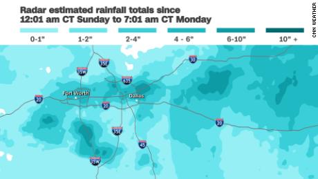
Monday’s rainfall has pushed this month to the third-wettest August on record for the Dallas-Fort Worth area, with more than 7 inches in all so far — the most rainfall seen in the month since 1915.
Ahead of the Texas flooding, rain persisted Sunday in parts of Arizona and New Mexico following floods in prior days in parts of the Southwest.
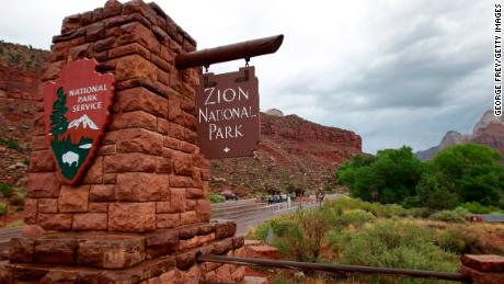
In Utah, hikers Friday were “swept off their feet” in Zion National Park by a flash flood. Search and rescue team members were working to find a missing hiker near the Virgin River, the park said Saturday.
The park was closed Sunday, the National Park Service said. “Maintenance crews will begin to assess and clean debris from the roadway,” the National Park Service added.
CNN meteorologist Monica Garrett, Dave Alsup and Raja Razek contributed to this report.